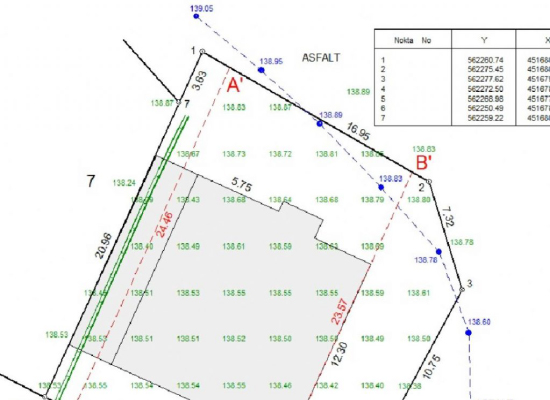
Plankote
These are large-scale maps that show the topographic condition (three-dimensional map) of the land with land details to form a basis for projects. This process is delivered to you after measurements and drawings are made by our company within the scope of map engineering services. It is about detecting the faults in the land and making the analysis by reading the land elevations correctly in order to carry out the projects and applications correctly.